Contents
The “X-Plane 10 HD Scenery Mesh v3” scenery is completely free to download and free to use. I call it Donationware because if you like the scenery, you are invited to donate for it:
Update
Dec 9, 2017
I recommend you to only use this for X-Plane 10. For X-Plane 11 there is now HD Mesh Scenery v4!
License
DO NOT REDISTRIBUTE / MODIFY / OR CHANGE (for 3rd party purposes) any parts of “HD Mesh Scenery v3” without asking for permission in advance (usually I allow almost everything, but I like to know about it!).
Introduction
X-Plane 10 HD Scenery Mesh v3 is an update to the older v2 HD Mesh (and a replacement of the default Global Scenery) and brings a lot of improvements in many areas!
Covered Regions (see coverage on the download map below):
- Europe (Canaries included)
- North America (USA, Alaska, Canada)
- Japan
- Hawaii
- Australia
- Himalaya (covering: 70E – 100E, 24N – 38N)
- NEW: South / Central America

General characteristics
(some improvements were mostly in v2 too, but some are new to v3)
- It is a much higher resolution base mesh (more, smaller triangles) compared to the default Global Scenery which ships with X-Plane 10 (one could say: approximately 3-4-times more dense). This has been increased over v2!
- The higher resolution mesh allows for a much more detailed representation of the elevation profile of the landscape
- The higher resolution mesh allows a much more detailed/exact representation of the underlying landclass data (because of the smaller triangles, which can follow landclass changes in the raw data more closely)
- It is based on fresh Openstreetmap (OSM) data from: approximately 10th of October 2014 / for Himalaya end of April 2015 / South America 25th of October 2015, which brings (compared to default Global Scenery) a lot of improvements in:
- water features (lakes, rivers, coastline) – many previously missing water features are now finally there
- roads
- railroads
- power lines
- urban park areas
- (was in v2) It includes line rivers from OSM (not just polygons as before) tagged waterway=river which improves the landscape in most regions quite a bit
- Water features (lakes / rivers) in Canada are now sourced from original government data instead of OSM (because OSM had some quite big gaps).
- (was in v2) Uses improved urban zoning (thanks to improved algorithms in the scenery generator)
- Many smaller and larger landclass data improvements
- Himalaya region has its own high resolution landclass data
- Australia has now its own higher resolution landclass data
- Europe received forest detail improvements by mixing in “Landsat Tree Cover Continuous Field” data
- (was in v2) completely replaced the landclass data for Canada (big improvements)
- (was in v2) Japan has now its own higher resolution landclass data
- (was in v2) some new classes added (in many regions), like: moraines, riverbeds, mining/dump sites
- (was in v2) added differentiation between ice (perennial) and snow (more temporal) to have an even more detailed representation of mountains. There is a nice description of this by Albert (the texture master) on x-plane.org: follow this link
- (was in v2) added differentiation between irrigated / non-irrigated crops (in some regions – like the USA etc.)
- (was in v2) Completely replaced the elevation data with viewfinderpanoramas.org (if you have a few cents, donate to that guy!). This doesn’t changes much in areas which were already great, but fixes some which were really hosed.
- Latest airport data (end of September 2014) boundaries used, to have up to date airport areas.
Fixes / Improvements in v3
- Much smaller forest type changes are now correctly depicted, bringing more versatility to the forest landscapes.
- It turned out (thanks to a user report), that in Northern Europe, I did a misinterpretation of the underlying, raw landclass data, and thus introduced too many forests (where normally the land would be wet grassland –> “inland marshed” and “peat bogs”).
- Square (orthogonal boundary lines) forest areas inside large forest stands (where inside the big stand the forest type changes – often visible in Canada, or where you have large, extended forests). This was a very long standing, and annoying problem (or side-effect) of the scenery generator, which I could finally fix to a level, where the internal forests patches look much more natural now (the orthogonal/square pattern is now definitely mostly gone).
- Intermittent Water features (and OSM tag) removed (quite common in Canada).
- Roads all over the airports – this was a bug of the scenery generator. This is now fixed. In v3 there will still be OSM based roads inside airport boundaries, but they are eliminated from runways / tarmacs / taxiways.
- Mesh spikes (a few in Southern Louisiana, in NE Alaska around the Canadian border, and one in Massachusetts) – these are coming from the source elevation data. They have now been fixed in the source data as of April 2014.
- Some roads missing in the center of some cities (like for example in Rostock / Germany) – usually those were roads marked as “pedestrian only”.
- Some railroad lines appeared, which did not exist at all (for example at Miami Intl.) – turns out, my import script didn’t remove some historical railroad lines. This has been fixed.
- Highway 1 across the Florida Keys was missing – in this case it was a shared vector which also had historical railroad tags and was thus removed. This has been fixed.
- Some lakes and water featues were missing (like Silveretta Stausee) – these lakes had some less common “leisure” tags and were filtered out. For example “natural=water AND leisure=marina” have not been imported in v2. This has been fixed.
- You might have seen excessively high skyscrapers in very few locations (known places are Manhattan, Honolulu) in very rare cases (interestingly this issue does not show up on 99% of the installations … and even when it shows up, its not always reproducible over recurring sim starts … and yes, I could verify, that at least on the data side, they are indeed present in the DSF scenery data). This is a known bug in the scenery generator, which has already been fixed. Thus, these skyscrapres should be eliminated in v3.
- Deep “canyon” around Telluride (east of KTEX) … Obviously the river-in-mountain-smoothing-algorithm went haywire here. This river – and a few more – should be fixed in the next version, but I can’t make this 100% perfect, so there will always be a few, remaining “offenders” I am afraid.
- Many airports have trees on them, their terrain is not appropriately smoothed or they have no grass on it. Usually this comes from outdated apt.dat (the basic information about airport layouts in X-Plane) used at the time of the scenery creation. More than 850 airports (freshly from the X-Plane Gateway ) have received an update in v3.
Warnings / Requirements
- The scenery requires at least X-Plane 10.25 (beginning with 10.25 beta 1) which provides quite a few new terrain types/textures which this scenery relies on! Without it, your X-Plane will very likely crash on scenery load!
- Please only download a smaller ZIP file at the beginning! Then test if it works for you and only then continue downloading other tiles! Do not unnecessarily overload the hosting providers! If possible, use the BitTorrent option at flightsim.com!
- You might need very long time to download all tiles. Single file sizes go up to 3,6 GBytes! In the map you can see the size of each tile.
- Your X-Plane 10 FPS might become very low (if you already have FPS problems, this will not improve your situation!)
- 32bit X-Plane will often crash and is no recommended! Scenery shifts (when new, adjacent tiles need to be loaded) exhaust the usual 32bit memory address space most of the time.
- If you have less than 4 GBytes of RAM, don’t even try! With 64bit, I recommend at least 8 GBytes or RAM for a smooth (hopefully crash free) experience (and if you combine it with other scenery and want to be on the safe side, take at least 16 GBytes of RAM)!
- PLEASE READ AND FOLLOW THE INSTALLATION (AND THE SCENERY_PACKS.INI SECTION) INSTRUCTIONS CAREFULLY, as most of the problems result from an incorrect installation!
- If it still does not work on your machine, there is not much I can do for you (mostly because of the above limitations)!
Download
Mirrors / Torrents
You can click on the desired tile in the following map, which will open a little balloon, including the file name / file size and the direct link to one of the mirrors:
- flightsim.com (with offical torrents!)
- isdg.com.au
- aerosoft.com
- x-plane.org no more hosts themselves but link to the ISDG files
where the files are hosted (the files are identical across all sites, you only need to download one of them). You can (and should) choose one of those sites with the least traffic bottleneck (you might try, and see how fast your downlaod goes).
flightsim.com supports torrents now out of the box! You can (and should if possible!) start using BitTorrent directly on the respective flightsim.com download pages (the links in the dynamic map will bring you there)! Look for the tiny, round, blue button with “qb” written on it: ![]() !
!
flightsim.com also offers you a first class membership (which at $30 for a year is less than many other, commercial add-ons might cost you), which removes all bandwidth limits for direct downloads at flightsim.com (other than the ultimate, physical limit posed by their server / ISP environment which is shared among all users). The flightsim.com BitTorrent support does not need a first class membership!
If for some reason the map does not work, the following links will bring you directly to the list view on the respective hosting sites:
A complete list of all torrents is also available here (thank you ISDG):
Chris K from ISDG says:
Via DVD delivery
HD Mesh Scenery v3 is now (since 07.01.2015) available on 26 DVDs (!!) from www.fspilotshop.com! Follow this link, to go to their offer:
The price in the shop is only there to cover the work / DVD media / deilvery (and NONE of that money comes to me!), so it still remains freeware / donationware!
Installation
Please follow these few steps as closely as possible (otherwise you can easily end up with a hosed installation – and might not even notice):
- Create a Subfolder called zzz_hd_global_scenery3 in your Custom Scenery folder (using the zzz_ prefix should highlight, that this package should load at the “bottom” of your scenery list!)
- Create a Subfolder called “Earth nav data” in your zzz_hd_global_scenery3 folder. Here, its very important to name it EXACTLY – without the quotes – “Earth nav data” and don’t make any typos (it is also case sensitive)!
- After you have uncompressed the ZIP file(s), put the resulting scenery folders (they should have names like +50-130,+30-120,+40+010 etc.) in the previously created (sub)folder “zzz_hd_global_scenery3/Earth nav data“!
- Now you can continue with the scenery_packs.ini section if this is your first HD Scenery Mesh v3 package! Otherwise (if you correctly edited the scenery_packs.ini previously) you can now start flying.
(If you have successfully installed HD Mesh Scenery v2, then you can follow the same procedure for v3. I only recommend, that you use a new Custom Scenery folder for v3 like: zzz_hd_global_scenery3)
If you are still not sure, how your folder structure should look, it should resemble something like this (this is an example with only some of the packages/regions visible):

Scenery_packs.ini
This part is very important! If you do not do this, you will very likely NOT see any of your other add-ons (airports etc.) in a given region anymore! The reason is, that a “base mesh scenery” (which the HD Mesh Scenery v3 is) forms the base of your landscape and only layers above it will be rendered! Anything below the base mesh layer will not even be loaded.
(You only need to do this once, when you install your first HD Mesh Scenery v3 package … All other packages are going in the same Custom Scenery folder, so they don’t need extra attention)
Beginning with X-Plane 10.10 there is a new “layer control”, which sets the order of the custom scenery layers explicitly. This happens with the file Custom Scenery/scenery_packs.ini and is documented here: http://developer.x-plane.com/2012/07/scenery_packs-ini-what-was-i-thinking/
WHAT TO DO (Here are the most important points):
- If you start X-Plane 10 the first time OR deleted(!) the scenery_packs.ini, it will create a new scenery_packs.ini and populate it exactly in the alphabetic order of your current folder names in “Custom Scenery” (in this case, the zzz_ prefix helps).
- If you already have a scenery_packs.ini (you have already run X-Plane 10 at least once), any new folder in “Custom Scenery” will be put automatically on the TOP (beginning) of scenery_packs.ini (which puts your new scenery folder at the highest level)!
- You can (and should) always manually sort / organize the scenery_packs.ini, as X-Plane only rewrites it when you delete it
- For HD Mesh to work well with other Scenery Packages, its best to put it at the bottom(!) of scenery_packs.ini! You can either copy the entry manually to the bottom, or if you don’t care, you just remove scenery_packs.ini and when its recreated the next time, the HD Mesh folder lands at the bottom (as it will be sorted in that position alphabetically)
IMPORTANT: KSEA Demo Terrain exception! Usually, with every XP10 install, you also receive the KSEA Demo Area. The problem is, that the KSEA Demo brings its own, 6 mesh tiles (which of course are at default mesh quality 🙂 ) … And if this entry in the Custom Scenery is above your HD Mesh Scenery v3, then it will trump it. So, please make sure, that in the scenery_packs.ini you:
- MOVE this: “Custom Scenery/KSEA Demo Terrain/”
- BELOW this: “Custom Scenery/zzz_hd_global_scenery3/”
OR
- Simply change the line to DISABLED (in this case you do not need to move the line around):
SCENERY_PACK_DISABLED Custom Scenery/KSEA Demo Terrain/
This will prevent, that X-plane loads the low res Demo Terrain (and instead you should finally get HD Mesh Scenery v3 there
If you want to learn more about how to best combine different scenery types and how to best use scenery_packs.ini, you might read this useful tutorial over at ASN-XP:
- http://asn-xp.aerosoft.com/?page_id=9708
How to know if the installation was correct?
After some time, it turns out, that more often than I thought (or hoped), people have a broken installation and do not see/use HD Mesh Scenery (even if they think so). There is a very easy and straight forward way (other than obvious or less obvious visual cues) to check, if X-Plane is really loading the HD Mesh Scenery (and thus, your installation was correct).
- After a – hopefully – correct installation and correctly setting up scenery_packs.ini (see above) start X-Plane at a location where you have added HD Mesh Scenery coverage (of course, it makes no sense to check where you do not have it)!
- When X-Plane has loaded up your airport and you see the scenery, close X-Plane again cleanly (this makes sure, that really everything has been written to the Log.txt).
- Now open a file browser, go to the root directory where X-Plane is installed and open the file Log.txt (thats where X-Plane logs everything good or bad).
- Search for text like “zzz_hd_global_scenery3” (or the EXACT name you called the installation folder inside “Custom Scenery”).
- If you find multiple lines, which look like “DSF load time: 5869136 for file Custom Scenery/zzz_hd_global_scenery3/Earth nav data/+40-130/+48-123.dsf (635549 tris)” (of course, exact dsf file name, and numbers will vary depending on the place you loaded up) then everything is OK! X-Plane is indeed loading DSF (Scenery) files from you HD Mesh Scenery installtion.
- If you do NOT find any such line mentioning loading HD Mesh Scenery v3 DSFs (with “DSF load time …. for file Custom Scenery/zzz_hd_global_scenery3/Earth nav data/ …”), then something went wrong and you should carefully re-read the installation instructions!
Known issues
In the meantime there are already quite a few known issues, which will (or will not) be addressed in a future update / release:
- Strange plateaus around airports or water running up the hills. In most (if not all cases), this is not an error in the HD Mesh Scenery itself, but a result of disabling “runway follows terrain contours” in X-Plane Rendering Options. So, whenever you see something strange happening around airports, first try to enable “runway follows terrain contours” before you report an issue! A short explanation: if “runway follows terrain contours” is disabled, then X-Plane flattens the entire airport area to a given – constant – elevation (the elevation values is by the way encoded in the nav.dat – airport data … and can be edited / corrected with WED).
- Airports have trees on them, their terrain is not appropriately smoothed or they have no grass on it. Usually this comes from outdated apt.dat (the basic information about airport layouts in X-Plane) used at the time of the scenery creation. This can happen at any time when newer apt.dat is introduced (sometimes even by airport sceneries themselves).
- Thin land “bridges” are observed in some locations (until now, reports are from Australia). This is usually a small “data bug” coming from OSM (all water features in the mesh come from OSM) and is usually not easy to diagnose (in online OSM viewers you can barely notice it – but its possible … and should be easier to spot in dedicated OSM editors). The problem is that the inland river or the bay is represented as a separate polygon from the the ocean and at the seam, where they meet, they not have been perfectly aligned (and I really mean, perfectly aligned! Because “small” errors introduce these dreaded gaps). This small gap is then “re-created” by the scenery generator as a land bridge, The best way to fix it (and this is “best practice in OSM” terms – and topologically correct) be achieved by sharing the nodes between the inland water polygon and the ocean “coast” (this guarantees, that no gaps can crop up)! Or if this would be too “complicated” (I rarely use OSM tools), then at least make the inland water nodes snap exactly to the nodes of the coastline nodes! This – of course – is not a quick fix, as it will only show results when the mesh is re-created from fixed OSM data … at some point in the future. Here is a list of already known locations (click the links), where the problem has been identified – they might already have been fixed when you look at them at some later time: Problem 1, Problem 2, Problem 3
- Lakes missing, which are tagged leisure=nature_reserve in Openstreetmap. This problem in the OSM import filter was only discovered shortly after the OSM data import/processing for HD Mesh Scenery v3 has been completed. This means, that all lakes (based on my researches, less than 100 are affected on the entire planet) which have the additional OSM tag leisure=nature_reserve, are NOT present in HD Mesh Scenery v3. This bug has been fixed internally, but will only take effect, whenever (which is completely unknown at this time) a re-cut will take place. A good example for this problem is the Lagunan di Ponente in Italy.
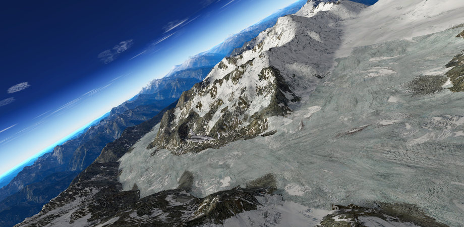
Screenshots
Here are the official screenshots accompanying the release of HD Mesh Scenery v3. Just follow the links to my Google Photos albums:
- HD Mesh Scenery v3 – FINAL
- HD Mesh Scenery v3 – FINAL comparison shots
- HD Mesh Scenery v3 – Winter in the Alps (using Winter_Package 1.1 from Xflyer aka. Albert Laubi, the “father” of the XP10 default textures)
FAQ
Difference between HD Mesh Scenery v3 and SimHeaven.com photoscenery!
SimHeave did take off-line all its photoscenery offerings, so this section is only here for those users, who did grab that scenery while it was available!
There still seems to be a great amount of confusion about the similarities / differences between the two scenery projects and when, how, which one should or can be used:
- HD Mesh Scenery v3 (what you are looking at here!)
- HDv3-based dsf for photo sceneries (what SimHeaven.com offers)
So, I wanted to make clear some points here, because the one is NOT the other, and the other is not the one (while they still share a lot)!
As the name already suggests, “HDv3-based dsf for photo sceneries” is based on this work, the HD Mesh Scenery v3 (… so, HD Mesh Scenery v3 is the source, from which the photo scenery is derived!). And because of this, they are identical in many ways:
- having exactly the same road, railroad, power line data (which comes from OSM)
- having exactly the same water features like lakes, rivers, coastline (which is derived from OSM too)
- having exactly the same autogen information (which is based on a mixture of 3rd party landclass data + OSM roads / railroads)
- having exactly the same forest data (which is based on 3rd party and not from OSM!)
The ONLY big – but important – DIFFERENCE is:
- HD Mesh Scenery v3 shows you generic textures (the same set which comes with XP10.25) which are placed / spread out based on very detailed landclass data.
- HDv3-based dsf for photo sceneries shows you photo textures usually derived from google maps via the tool g2xpl!
- There is a second, less know difference because of the way how textures are applied. The tool g2xpl “slighty” re-cuts the irregular(!) triangle mesh structure of HD Mesh Scenery v3 into rectangular patches, so it can apply the rectangular photo texture tiles onto those small rectangular triangle patches. Because of this – the changed triangle mesh structure – “HDv3-based dsf for photo sceneries” can sometimes have a little bit different elevation representation (usually only seen in mountainous areas with a lot of fine grained changed in elevation data).
After all, this also has another important implication! Because both sceneries have a base triangle mesh included (a base mesh), they can only be used in X-Plane 10 exclusively! They can’t be mixed (for very good technical reasons)! If you have more than one of them (and the default Global Scenery counts too) installed in the same place, then X-Plane 10 will only show you the one with the highest priority in the scenery_packs.ini! The other one(s) will just sit on your disk and take up place (but there are no other problems to be encountered)!
So, in the end its quite easy. You have to decide if you rather would like to see photo textures or if you are much more happy with the (intricate, complex and usually good looking) generic texturing approach. Because everything else is – usually – similar in both sceneries!
Why is region X not covered?
This question has been asked so many times, that I think, I should finally – should have done so a long time ago – post about it on this page too:
The real problem is not so much “my preference” for Europe or North America or Australia. The problem is much more, that I do not have equally good data for all parts of the world! The greatest problem is usually land cover data, which gives the fantastic detail to the landscape (or lets it look dull … if there is no good enough data). Europe and North America (and New Zealand, Japan and lately Australia) do have very good (or sufficiently good/usable sources which can be mixed well enough to get good results) land class data, which allows me to create the great scenery you have now … the HD Mesh Scenery. .
A very good example, where you see how much difference good land class data makes, is my latest Japan effort. See the comparison screenshots:
The default Japan scenery has the same quality land class data as for example South America … and then see, what difference the new, high resolution land class data makes! And exactly thats the problem … because I usualyl need land class data which is:
- high resolution
- good quality (its very hard to quantify for “outsiders”, whats good and what is not so good –> but the better the data, the less time I need to work on it … but rest assured, there is no geodata which can be used out of the box)
- with large area coverage (the larger the covered area, the more my time investment can pay off)
- free (yes, that is something quite important, as I try to continue to keep the “product” free / donationware)
Without data like that, it makes far less sense to create a HD Mesh scenery for a given region.
BUT: rest assured, usually I am almost always scouting for new land class data! Whenever there will be good data for other regions, I will be there to check it out and generate scenery from it (if it is reasonable).
Is the scenery compatible with Windows / Mac OS / Linux ?
The simple answer is: YES!
The good thing in X-Plane is, that as long as a scenery only contains data (which is the case with this scenery) it is always completely OS independent (the scenery data is identical for all OS versions of X-Plane)! Only if a scenery uses plug-ins (which this scenery does not) can you have OS dependency.
Can you modify the mesh for your own scenery projects?
I have added a big FAQ topic to answer this question (as it is common to all of my mesh products). Read it very carefully, as it will address a lot of possible issues which you might face when deciding to make your own modifications:
Data Sources / Acknowledgments
The following data sources have been used to make this scenery possible (none of them has been used in its “pure”, raw form but all have been mixed / merged together in one form or other, to achieve these results):
- Elevation data:
- Land cover data:
- Europe, CORINE from EEA
- USA, NLCD from MRLC
- Canada, Land Cover, Circa 2000
- World, GlobCover
- New Zealand, LCDB
- Japan, ALOS Land Cover, from © JAXA
- + JPGIS2.1, KSJ –> Zoning
- Australia
- Himalaya Region Land Cover Mapping
- ESA CCI Landcove (first used for South/Central America)
- Additiona forest data:
- MODIS NDVI
- Landsat Tree Cover Continuous Fields (improving forests in Europes land cover, making them more detailed)
- Climate:
- Vector data:
- OpenStreetmap
- CanVec from GeoGratis (Canadian vector data used to have a complete coverage of – almost – all water features in Canada! There, its the single source – instead of OSM – for water features.)
- Popultaion density:
- Gridded Population of the World (GPW)
- Worldpop.org.uk (only partial use)
- Glacier data (to differentiate between snow and ice):
- Irrigated, non-irrigated land:
Contact
If you need to contact me, you either find me in most of the well known X-Plane related forums (my pseudonym is: alpilotx) or use the e-mail address on the contact page!
Have a lot of fun!
Andras Fabian
www.alpilotx.net
Extras
X-Plane 10 Tree Lines and Farms v2
You might consider adding another – free – little add-on from this site, which helps to improve the overall feeling (especially in large, agriculture / pastures dominated regions!):
Bonus experimental (dense) forests
Experimental, dense XP10 forest replacement! This is the same package as from the HD Mesh V1/V2 download (so, if you have downloaded it from there, you do not need to do it again)!
If you want to try out a bit more dense forests in X-Plane 10 (maybe together with the above HD Scenery), then you might be interested this:
- Download this ZIP file: http://alpilotx.de/data/xp10-dense-forest-replacement.zip
- Unzip it (you should get 261 FOR files)
- Put the 261 FOR files in the X-Plane 10 folder: /Resources/default scenery/1000 forests/ (if its warning you about overwriting existing files, then you are doing the right thing – otherwise, you have choosen the wrong place)
- Before overwriting, you might consider backing up the folder! But any X-Plane update would restore it to its original anyways (if you allow it to do so)
A few things to consider with this experimental(!), dense forest replacement:
- It will probably make your FPS worse! (depending on your 3D card, this effect might be more or less strong)
- At each update, X-Plane will ask you, if it shall overwrite the contents in the /1000 forests/ folder (restore it to the original, X-Plane “default)! You can always deny, or accept it (this way, you can get bet the default, even if you didn’t do a backup). And from time to time, you SHOULD go to the X-Plane default, as it will be improved too (over time), so you might miss out on improvements there!
- PLEASE DON’T REDISTRIBUTE this forest replacement pack! Its experimental, and should remain as such. Over time, I think we will tune X-Plane 10 default forests to a point, that you won’t even consider this pack anymore.
Have fun with it!